Overview
Distance: ~ 7 miles (round trip)
Elevation Gain: 5124 ft to 7165 ft = ~ 2041 ft
Time: 3-5 hours (round trip)
Time: 3-5 hours (round trip)
Date: June 7, 2012
How to get there from BYU:
View Larger Map
Trail:
Description:
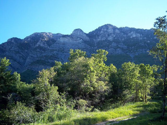
The Rock Canyon trail has some of the most beautiful views around. The rocks rise up in great cliffs and swirls on both sides.
 |
| The trailhead |
The cliffs near the trailhead are a favorite of climbers.
 |
| Going up! |
 |
| Don't let go |
 |
| A gravelly section |
However, without stumbling over the rocks, be sure to look up. There is a lot to see along the way.
 |
| Sqauw Peak |
 |
| Looking up towards Y-mountain |
 |
| Mountains have layers |
 |
| A cool swirl in the rocks |
 |
| More impressive cliffs |
The trail follows along a small stream. I've never seen it flow down as far as the trail head but you generally reach it within the first mile -- depending on the time of year. It must have been fairly impressive in the past though considering all of the cement work near the trail head.
 |
| Give said the little stream |
 |
| A little waterfall along the way |
Along the way you'll see evidence of an old aqueduct. It has since been replaced with pipes running under the trail. Every once in a while you'll see the pipes stick out and sometimes you can even hear the water running under the trail.
 |
| A portion of the aqueduct that has broken near this bend in the rock |
There are 5 bridges along the way -- all before the Squaw Peak trailhead. Most of the time the stream is low enough that they aren't really needed though. They were just replaced earlier this spring and are in very good shape.
 |
| Bridge 2 |
 |
| bridge 3 |
In between the 4th and 5th bridges there's a side trail to a cave which then joins back up to the main trail. The cave doesn't go very far in but is fun to check out nevertheless. Found bats in it once, so I've named it the Bat Cave.
 |
| Bridge 4 - The trail to the Bat Cave is to the left |
 |
| The 5th bridge - the Bat Cave trail joins back up on the other side of the bridge |
 |
| No, I don't think Batman lives here |
 |
| The Sqauw Peak trailhead |
 |
| I think there used to be a sign here but I'm not sure what for |
 |
| The 2nd of the two fountains. Drink up |
 |
| Klimeck Trail |
 |
| Looking back to Provo |
 |
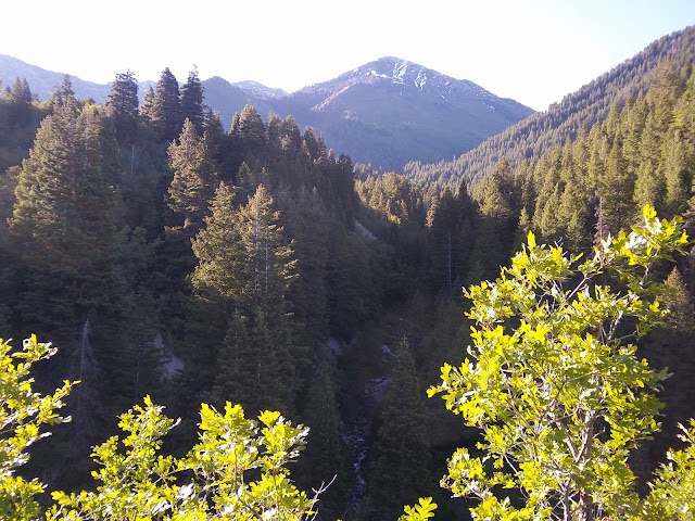
| Looking towards the south. Rock Canyon stream below, Provo Peak above |
 |
| Close-up of the stream |
 |
| Looking up the canyon followed by the Klimeck trail and back of Y-mountain |
 |
| Shingle Mill and Freedom Peak to the East |
Not long after this view point you'll begin to pass through meadows. The grass can be tall and wet and I saw some nettles along this last part of the trail so be sure to wear some decent pants. The meadows come right before the Rock Canyon Campground. I've never seen anyone at this campground before but the facilities look nice and it appears to be reservable online.
 |
| The meadows before the camp |
 |
| Entering Rock Canyon Campground |
 |
| Cascade Mountain |
 |
| Shingle Mill Peak on the left and Freedom Peak on the right |
Follow the 060 trail signs through the camp. It will eventually lead you out the other side till it goes back into the woods.
 |
| Back into the woods |
This part of the trail goes for about a quarter of a mile to where I'm placing the end of this trail and the beginning of the Dry Fork trail -- though technically they are both labeled trail 060.
 |
| End of Rock Canyon and beginning of Dry Fork Canyon |
Geocaching
There are quite a few geocaches along this part of the trail though many of them can be challenging to get to. It can also be a bit tricky getting good satellite reception in the narrow part of the canyon.
Other Links:
Rock Canyon Campground


No comments:
Post a Comment